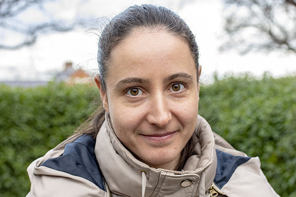
Dr Stefania Cerretelli

Agriculture, Health and Environment Department
Natural Resources Institute, Faculty of Engineering & Science+44 (0)1634 88 3015
Dr Stefania Cerretelli obtained the Bachelor Degree in Natural Science, and the Master Degree in Environmental Biology at the University of Trieste (Italy) in the 2010 and 2013, respectively. She obtained a PhD in Ecology with the title “The role of ecosystem services in the spatial assessment of land degradation: a transdisciplinary study in the Ethiopian Great Rift Valley”. Her PhD was part of the ALTER (Alternative Carbon Investments in Ecosystems for Poverty Alleviation) project, a three years international and interdisciplinary project funded by ESPA (Ecosystem Services for Poverty Alleviation) with partners from UK, Ethiopia, and Uganda. For the PhD I spent three year at The James Hutton Institute in Scotland (UK).
During her Master’s and Bachelor’s Degrees she developed experience in planning and conducting environmental surveys (such as vegetation surveys as well as mammals monitoring).
For her PhD, she mapped the landscape capacity to supply ecosystem services (carbon storage, soil retention, and nutrient retention) integrating data from global datasets, as well as soil properties data from a local survey, and a supervised land use classification. The spatial modelling was mainly done using R-Cran and GRASS GIS. Moreover, she developed and implemented a participatory approach (through single interviews, focus group discussions, and participatory mapping) that involved local stakeholders. The spatial data and the local participatory knowledge and information were finally integrated in a spatialised Bayesian Belief Network model to map land degradation risk in several land use scenarios.
Throughout the three years of the PhD, Dr Stefania Cerretelli gained good knowledge of and experience on Remote Sensing techniques and GIS-based systems (e.g. GRASS, QGIS, and ArcGIS), programming and statistical analysis skills including BBN statistics (mainly using R-Cran Software), good skills in managing large sets of data, as well as good written and oral communication skills in English. She has experience and good skills both in quantitative (spatial modelling and statistical analysis) and qualitative research methods and analysis (participatory approaches and text mining analysis).
During the PhD she worked with important academics in her own field: Alessandro Gimona, Laura Poggio, Helaina Black, Mike Rivington, Alessandro Peressotti, Tewodros Tefera.
Her main research interests are in remote sensing modelling, and especially ecosystem services modelling.
She is interested in the integration of remote sensing data and field data to model important environmental factors or services; these models are an important means to inform decision making processes that could help supporting the adoption of better management in order to foster a sustainable development. Another interest of Dr Stefania Cerretelli is to integrate biophysical data and stakeholders’ knowledge to gain a better perspective of the study area. This is important to assess different trade-offs between sustainability, agriculture productions, livelihood diversification, as well as other factors such as poverty eradication and well-being.
These aspects can be evaluate through ecosystem services modelling (using remote sensing data, field data, land cover classification) and bayesian belief networks which enable the integration of quantitative data and qualitative data and which account for uncertainty, an important factor in complex systems such as agroforestry and agro-environmental systems.
Dr Stefania Cerretelli has been associated to the following Funded Research Projects.
ALTER project - Alternative Carbon Investments in Ecosystems for Poverty Alleviation (2013-2017).
ALTER aimed to demonstrate the benefits for wide scale poverty alleviation by tackling soil degradation, from field to landscape, by carrying out studies in Ethiopia and Uganda, bringing together natural scientists, social scientists - along with local communities and decision makers - to improve our understanding of how human-environment linked systems respond to incentives and other change.
The project was an international consortium between The James Hutton Institute (UK), University of Aberdeen (UK), Hawassa University (Ethiopia), The Ethiopian Government's Southern Agricultural Research Institute (SARI, Ethiopia), Carbon Foundation for East Africa (CAFEA, Uganda) and the International Water Management Institute (Nile Basin & Eastern Africa Office, Ethiopia).
For the above-mentioned project, Stefania mapped the distribution of ecosystem services and the integration of social and economic aspects with the environmental factors in affecting the land degradation.
Sustainability-Intensification Trade-offs in Coffee Agroforestry in Central America
The project “Sustainability-Intensification Trade-offs in Coffee Agroforestry in Central America” is funded by the University of Greenwich and have as partners CATIE in Costa Rica (The Tropical Agricultural Research and Higher Education Center) and the Universidad del Valle de Guatemala)
Coffee agri-systems vary from intensive monoculture plantations to forest-like coffee agroforests and therefore provide a model system to evaluate the trade-offs and potential synergies between intensification and sustainability. Coffee agri-systems will be compared in two countries in Central America, Costa Rica where production has been more intensive even within agroforestry systems and Guatemala where traditional coffee agroforestry systems predominate. A long-term coffee agroforestry experiment was established in Costa Rica in 2000 comparing different agroforestry shade trees and coffee monoculture under different levels of agronomic inputs. Provisioning, supporting and indicators of regulating ecosystem services will be evaluated in this experiment and on around 80-90 coffee farms in each country representing different typologies of coffee production. The typologies will cover a range of intensity of production (levels of fertilizer use) and sustainability (levels of shade trees). This will evaluate the capacity of each system to provide supporting services (light, nutrients and water) to sustain production and a coffee agroforestry model will estimate regulating services of greenhouse gas sequestration or emissions, and water balance and quality. The results of this project will inform the best strategies and support for farmers to enable sustainable productive livelihoods while meeting the product demands of markets and environmental demands of society. Ultimately the results should inform the ongoing debate in forums such as the Food and Climate Research Network on whether agricultural development should intensify production and spare land for the environment or opt for more sustainable production system providing ecosystems services but with a bigger land coverage.
- Cerretelli S., Poggio L., Yakob G., Boke S., Habte M., Coull M., Peressotti A., Black H., and Gimona A., 2021. The advantages and limitations of global datasets to assess carbon stocks as proxy for land degradation in an Ethiopian case study. Geoderma, 399, 115117.
- Cerretelli S., Poggio L., Gimona A., Yakob G., Boke S., Habte M., Peressotti A., and Black H., 2018. Spatial assessment of land degradation through key ecosystem services: The role of globally available data. Science of the Total Environment, 628-629, pp: 539-55.
Research fellow in Ecosystem Services for the project “SEACAF: Sustainability-Intensification Trade-offs in Coffee Agroforestry in Central America”.

